NISAR Level 2 Projections
NISAR Level 2 products are georeferenced and provided in map coordinates. The projected coordinate system used for each product will depend on its location, as described in Table 1.
Products between 60°N and 60°S are projected to the UTM Zone (WGS 84) appropriate for the product location.
Products north of 60°N are projected to the NSIDC Sea Ice Polar Stereographic North (EPSG 3413) projection.
Products south of 60°S are projected to the Antarctic Polar Stereographic (EPSG 3031) projection.
Table 1:Projections used for Level 2 NISAR products
The following figures illustrate the extent of the different projections used for ascending frames (Figure 1) and descending frames (Figure 2).
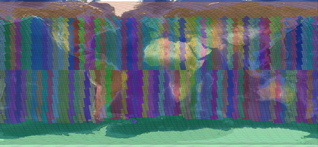
Figure 1:Different projections used for ascending NISAR frames.
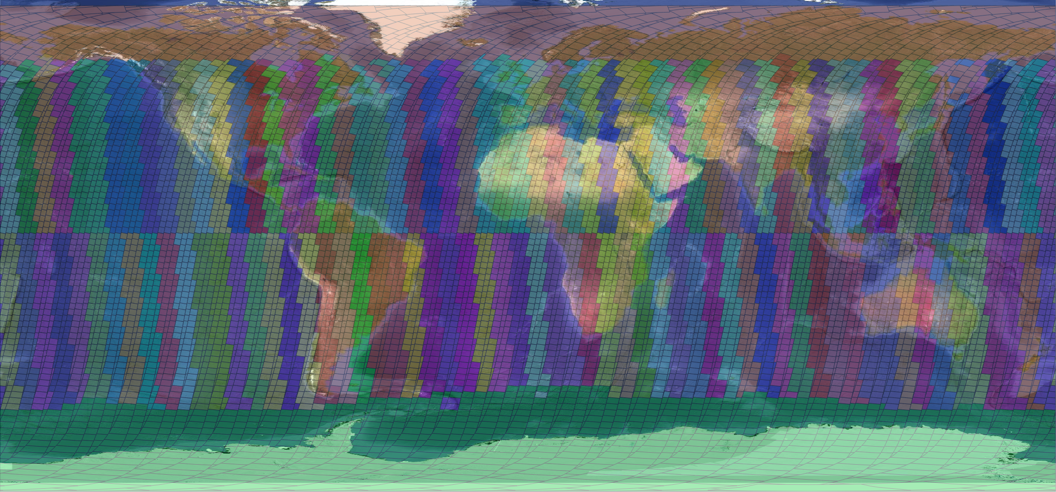
Figure 2:Different projections used for descending NISAR frames.
NISAR Level 3 Projections
NISAR Level-3 products (SME2) are posted to the global EASE Grid 2.0 (EPSG 6933) with a pixel spacing of 200 m.